How Google Earth Works

Most of us have been using one online mapping program or another for years now. They're a godsend for those of us who get lost within a 3-mile radius of our homes, and they're just plain fun for people who enjoy figuring out where stuff is.

With this in mind, imagine how amazing Google Earth must be for it to elicit awe from the online community and cause South Korea to demand changes to the program.

Advertisement

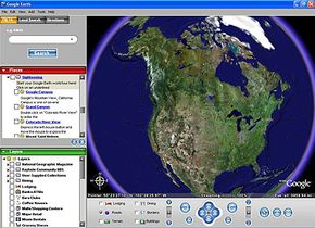
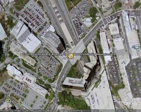
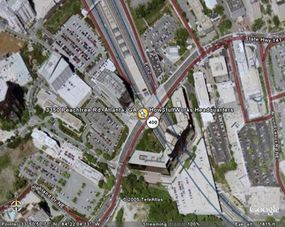
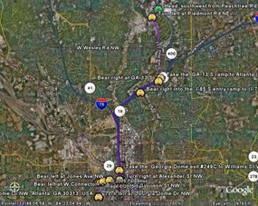
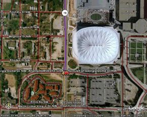
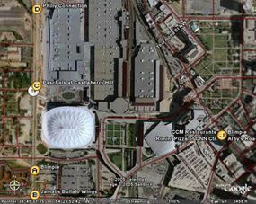
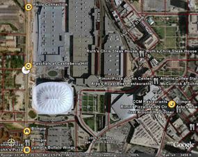
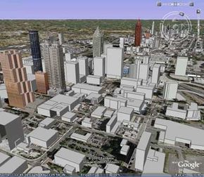
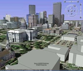
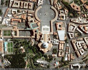
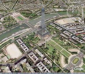
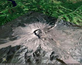
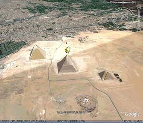
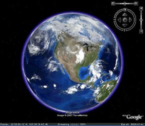
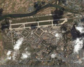
Google Earth is no ordinary mapping application. Type "Denver, CO" into the Google Earth search box, and yes, you can learn where Denver, Colo. is in relation to Grand Junction, Colo. and how to get from your address to 1600 Curtis St. in downtown Denver. In the same search, though, you can also learn that 1600 Curtis St. is in the 80202 zip code and that there are 12 Starbucks Coffee shops within a half-mile radius of that address; you can zoom out from 1600 Curtis St. and watch it disappear into a satellite view of the Earth and then zoom back in as if you were falling onto 1600 Curtis St. from space; and if you click on "Forbidden City" in the "Sightseeing" column, you can see what it would look like to fly Superman-style from 1600 Curtis St. in Denver to the Forbidden Palace in Beijing, China.

­And you thought the world was small before.

The ap­plication is fairly easy to use, but there are a lot of functions to try out. See how Google Earth gets images and data and learn how you can get started with Google Earth so you can explore some of the features and customization options.

Advertisement

What is the Google Earth software?

Google Earth launch page with toolbars.
Photo courtesy Google Earth™ mapping service

Google Earth is currently available for download as a desktop application, although you need to be connected to the Internet to use it. Every time you open Google Earth, it automatically connects to Google's servers, giving you access to terabytes of geographical, political and social data. For instance, you can view a city with certain "layers" turned on, including topographical information, population data and crime statistics for the area. The layers and all of the map navigation buttons, including zoom, tilt and rotate, are all located in the Google Earth frame.

The big deal right now is the basic version of Google Earth is completely free. Of course, this could change in the future. So let's all start by downloading the free version of the software located at Earth.Google.com while it's still free. If your computer runs Windows, Linux or Mac OS X 10.3.9 or higher, and it's fewer than five years old, you should have no problem meeting the system requirements. If your computer can't run the application, read on to find out what you'll be able to do once you update your equipment.

Advertisement

Once you open Google Earth and start moving around a bit, you'll immediately notice one of the biggest "whoa" aspects of the program: some of the information is 3-D, and the stuff that isn't 3-D is still a photograph -- there are no illustrated maps here. The baseline visual data comes from satellite imagery and aerial photographs taken by aircraft.

While Google Earth comprises an array of features that would probably take months to fully utilize, the basic features fit loosely into the following categories:

  • Mapping/directions
  • Local search
  • Sightseeing

The basic version of Google Earth is free, and it's an amazing piece of software. But in case you want more, or you intend to use the program for commercial applications, there are subscription-based versions of Google Earth that offer additional functions. Read on for a closer look at the basics. ­

Advertisement

Features of Google Earth Maps

Photo courtesy of Google Earth™ mapping service

­The best way to get to know Google Earth is to start with a location and see what Google Earth will tell you about it. So let's start with HowStuffWorks headquarters in Atlanta, Ga. If you type "675 Ponce De Leon Ave. Suite 4500, Atlanta, GA 30308," into the Google Earth search box and click "Search," you zoom in from space to HowStuffWorks headquarters. You are now looking at a photograph of the location.

To get more information and turn the photograph into a real map, the next step is to turn on some layers. Available layers include dining, lodging, banks, roads, terrain, malls, grocery stores, gas stations, parks, transit, schools and geographic features.

Advertisement

To create a nice, functional map, you might just turn on the "roads" layer. If you zoom out a bit, you've got yourself a good driving map of the broader area surrounding 3350 Peachtree Rd. in Atlanta.

Photo courtesy of Google Earth™ mapping service

Let's say your little tour of Atlanta includes a stop at HowStuffWorks headquarters followed by a trip to the Georgia Dome to check out a Falcons game. A click on the Google Earth directions button reveals two slots: one for the starting address (3350 Peachtree Rd. Atlanta, GA) and one for the ending address (1 Georgia Dome Dr NW, Atlanta, 30313). Clicking "Search" reveals both written directions and a highlighted route on the map, which has automatically zoomed out to accommodate the entire route from HowStuffWorks to the stadium.

Photo courtesy of Google Earth™ mapping service

Advertisement

Google Earth Search for Business

Photo courtesy of Google Earth™ mapping service

You can save, print or e-mail all of the maps and information you've generated so far. There are buttons in the Google Earth toolbar to accommodate each of these actions.

At this point, let's say the Falcons game is over and you're ready to grab a bite to eat. This is where the find businesses feature comes in.

Advertisement

The first thing we want to do is re-center the map so that the focus in on the Georgia Dome. To do this, we left-click anywhere on the map and drag it upward until the Georgia Dome is centered (alternately, we could also just put "1 Georgia Dome Dr." in the original search box and fly right there -- this would put the Dome in the center, too). You can zoom in now and get a pretty nice view of the Dome.

To find out what restaurants are located in the vicinity of the Georgia Dome, you click on the "Find Businesses" tab and enter, say, "restaurants" in the "What" box and leave the default "Current view" in the "Where" box. When you click on "Begin Search," here's what comes up:

Photo courtesy of Google Earth™ mapping service

The map zoomed out slightly and re-centered itself to fit in the most restaurant results while still keeping the Georgia Dome in sight. But that's not the only way to find restaurants. You can also turn on the "Dining" layer, which doesn't depend on any keywords but instead searches the entire Google "Dining" category for restaurants in the area. Here's what happens when you do that:

Photo courtesy of Google Earth™ mapping service

Now you've got even more options.

In this section, we've covered most of the basic functions of Google Earth. But most of what we've gone over here is covered in other mapping applications as well, although it may not be nearly as pretty as the view in Google Earth. What sets this program apart are the functions that make it a pastime, not just a utility.

Advertisement

Google Earth 3-D and Other Features

3-D Atlanta
Photo courtesy of Google Earth™ mapping service/Sanborn 2007 copyright

Video Flyovers

One of the most amazing aspects of Google Earth is the flyover. When you're looking at Atlanta, Ga., and you do a search for "Nepal," you don't just blink and end up in Nepal. The program flies you there, so you can see the terrain and all of the countries beneath you as you make your way to your destination. This video flyover feature is great when it comes to getting driving directions. At the bottom of the screen with your turn-by-turn directions, there's a "play" button. If you click it, Google Earth will fly you over the route, turning right and left and veering as required, so you can see exactly what it's going to look like when you drive it.

3-D Views

Google Earth has created 3-D buildings for many major U.S. cities. For the most part, they're not detailed replicas -- they're simple, gray 3-D drawings -- but you do get a very good feel for the city when you turn on this layer. Google Earth now supports textured (real looking) 3-D drawings. Some are built into the application, but mostly Google is now letting users create and import 3-D drawings themselves using the free Google SketchUp program. As with any other view, you can use the "tilt" and "rotate" buttons in the navigator panel to get the full 3-D view.

Advertisement

3-D Denver
Photo courtesy of Google Earth™ mapping service/Sanborn 2007 copyright

Sightseeing Across the Globe

If you haven't had time to travel the globe just yet, Google Earth is your new best friend. You can zoom in on global landmarks just by clicking on a location in the "Sightseeing" box, which lists the most popular destinations, including the Eiffel Tower in Paris, Arizona's Grand Canyon and Vatican City in Rome.

St. Peter's Basilica (domed building in lower center), Vatican City, Rome
Photo courtesy of Google Earth™ mapping service
The Eiffel Tower, Paris, France
Photo courtesy of Google Earth™ mapping service/The GeoInformation Group/InterAtlas 2007 copyright

OK -- video flyovers, 3-D views and sightseeing across the globe are pretty cool, but wait until you see what Google Sky can do.

Advertisement

Google Sky

Planets, stars and other heavenly
Photo courtesy Google Earth/DDS Consortium 2007

Google Earth wows users with its ability to fly to and from anywhere on Earth. In August 2007, Google introduced Google Sky, giving users the ability to actually take to the stars.

With one click of the mouse, a Google Earth user can switch to Sky Mode and reverse the perspective. With hi-res images from NASA, the Digital Survey Consortium and the Sloan Digital Sky Survey, Google Earth has put together an accurate and fascinating look at outer space. Users can fly around, just like in Earth mode, to search the far reaches of space.

Advertisement

As with the Earth portion, Google Sky has lots of layers you can display. You can find constellations by name or see them drawn out on your screen. The Backyard Astronomy layer references three astrological catalogs to give greater detail on some of the more well-known space objects. You can highlight galaxies, nebulae, star clusters and famous visible stars to get information on location, history, classifications and even links to NASA's database of information. There is also a Hubble Showcase that provides images taken from the Hubble Space telescope, along with some detailed data about the objects.

­Two very cool features of Google Sky are the Moon in Motion and Planets in Motion layers. These show the paths of the moon and the planets across the sky from your given location on Earth. NASA took pictures once every hour for three months to make sure the paths were accurate. A slider bar lets you choose the span of time you want to view. Then, you just click to see the moon or planets move. If you click on the moon itself, the program pinpoints its location on that date, the phase, how far it is from Earth and how bright it may look in the sky. Click on the planets, and you can find out their size, distance and magnitude.

Google Sky also provides two very interesting tours of outer space. The User's Guide to the Galaxy takes you on a trip through a number of well-known galaxies. The Life of a Star tour shows the lifespan of a typical star, from birth to death. A fact list shows what happens to each star and how it fits into the cosmic soup. In both tours, you can e­ither click on one at a time, or download it for one long trip through the universe.

Now that you know all the cool things you can do with Google Earth, let's find out where it gets all the data to make it work.

Advertisement

Google Earth Map Data

Mount St. Helens, Washington State, USA
Photo courtesy of Google Earth™ mapping service

Google Earth was once a premium program called Keyhole that cost about $90. When Google purchased Keyhole, it inherited terabytes of digital mapping data and set about creating a basic version of the software that would be available as a free download. Now you're all caught up.

The photographic maps available on Google Earth come primarily from two sources: satellites and aircraft. Google gets this imagery and other digital mapping information from sources such as TeleAtlas and EarthSat, both of which compile photographs and maps into digital form for commercial applications. Because the data comes from different sources, it's provided at different resolutions, which is why some areas of the globe appear crisp even at street level while others are blurry from a great distance. Google is striving to have as much high-definition coverage of the world as possible. When you use Google Earth, you're not viewing the imagery in real time: according to Google, the information is no more than three years old and is continually updated as new data becomes available.

Advertisement

Google Earth has several countries like the United States, Canada and the United Kingdom covered to street level, so you can zoom in and view road names and local businesses and get directions from here to there. The database has a good amount of information on other regions like Western Europe, India and Japan as well, but the rest of the world is hit or miss. While you can zoom in and get a pretty good look at the Egyptian pyramids, you can't see street names or find a grocery store in the area. Google is constantly adding more information to its databases, though, and the maps are getting better with each update.

This brings us to another source of Google Earth's data: the Google search engine. Part of what makes Google Earth so addictive is its collaboration with Google search. As you now know from the "How to Find the Fun Stuff" section, when you're viewing a city, you can search for coffee shops, restaurants, grocery stores, bars and tons of other businesses in the vicinity, and you can click on them to get detailed information from the Google search engine. Users can also add a business location to a map by clicking on "Add/Edit a Business Listing" in the Google Earth toolbar.

The pyramids in Egypt
Photo courtesy of Google Earth™ mapping service/Digital Globe 2007 copyright

Now that we know where the data comes from, we'll learn about what it takes to get that data to your computer screen.

Advertisement

Google Earth Technology

Virtual globes are actually made up of polygons.
Stockbyte/AFP/Getty Images

When using Google Earth, people can take for granted the ability to zoom in, rotate, pan and tilt on an image as specific as their own front yard. But the trick of Google Earth is not in compiling and storing all these images. It's getting them to your computer quickly and efficiently. With a 56k dial-up modem, it would take 12,400 years to download a one-meter resolution image of the Earth [source: Butler]. But Google Earth makes it seem like a high-resolution picture of the entire world is right in front of you. Figuring out how to move so much information was one of the program's biggest hurdles.

One way to cut down on transfer time is by using your computer's disk cache. You can explore the details about disk caches in How Caching Works. For now, let's simplify things and define disk cache as temporary storage for files your computer has already accessed. If your computer can temporarily store viewed images of the Earth, it won't need to retransfer the images from the source when you want to view them again. Google Earth counts on this technology to help speed up transfer time.

Advertisement

Another key to getting all that information on your screen has to do with how your computer processes and displays maps. Google owns several software patents that relate to how Google Earth functions. The one patent that really makes the whole thing possible covers something called Universal Texture. Universal Texture (UT) uses two methods for getting large amounts of information to your computer -- mip mapping and clip stacking [source: Tanner, Migdal, Jones].

Mipmaps are collections of bitmap images that work within a texture to create the illusion of depth. They work in an inverted pyramid structure, stacked on each other with each level having twice the resolution of the one under it. These stacks ultimately create a three-dimensional representation of a two-dimensional image.

Clip stacks are portions of giant mipmaps that are clipped to a specified maximum size. The benefit of clipping these enormous files is simple -- Google Earth relies on the fact that users will only need to see one piece of the mipmap at a time. When the user tells the program where they want to fly, the program uses an algorithm to figure out which sections of the larger virtual texture are needed and uses only those sections to create the final images [source: Tanner, Migdal, Jones].

Simply put, Google Earth has created a giant, multi-terabyte, hi-res image of the whole Earth and serves it up one small piece at a time in bites your computer can easily digest. Zoom in to your front yard, and the program clips away everything but the front yard and its surrounding area.

Now let's get back to playing with Google Earth. In the next section, we'll learn how Google Earth can be customized.

Advertisement

Customizing Google Earth

The Crisis in Darfur
Photo courtesy of Google Earth™ mapping service/TerraMetrics 2007 copyright/Europa Technologies 2007 copyright

One of the factors that makes Google Earth stand out from other mapping programs is the level of customization it offers. You can easily insert placemarks of locations you want to return to or overlay your own images on a map you create. It's all right there in the toolbar. And if you want to get really fancy, you can import your own files into Google Earth to display routes, points of interest, boundary data, et cetera. Much in the way an Internet browser reads HTML, Google Earth reads a language called KML. You can open your own KML file in the Google Earth application and see your data displayed on the Google Earth imagery. To learn about importing your own data, check out these links:

Google Earth features third party overlays and applications from time to time, including overlays sponsored by the Discovery Channel, National Geographic, the European Space Agency and many other organizations. Layers can highlight natural wonders, impressive achievements, environmental efforts and political issues. The following are just a few examples.

Advertisement

Crisis in Darfur -- an overlay developed by the United States Holocaust Memorial Museum that maps out the genocide in Darfur. When you activate the overlay, the Darfur region in Sudan is outlined on the globe. Markers appear where the Sudanese soldiers and Janjaweed militia have destroyed villages. The markers also tell you how many people were displaced as a result of the destruction of each village. The overlay includes images, video and articles about the ongoing crisis.

Geographic Web Layer -- a layer with three sub-layers: the Best of Google Earth Community layer, the Panoramio layer and a WikiPedia layer.

  • The Best of Google Earth includes a selection of the most popular placemarks created by Google users. Switching this layer on reveals tags (marked by a golden, lower case "i") that, when clicked, might give you more information about a location, a gallery of photos or even a link to a film about the area.
  • With Panoramio, you can geotag photographs and upload them to Google Earth. By geotagging a photograph, you anchor it to a specific location in Google Earth. For example, you would geotag a photo of Mann's Chinese Theatre to Hollywood, Calif. Panoramio examines all photos to make sure they're appropriate for inclusion with Google Earth. Photos should be clear, accurate and have the location as the focal point -- the service won't upload photos of you hugging your cat in front of the Eiffel Tower. Once approved, photo locations are marked with a Panoramio tag. Click on the tag and your photo appears.
  • The WikiPedia layer displays markers that are links to WikiPedia articles about the region. You can find articles on countries, states, cities or even individual buildings.

Read on to learn about more ways that you can customize Google Earth.

Advertisement

Google Earth Layers

Google Earth™ mapping service/NASA/TerraMetrics 2007 copyright

Wild Sanctuary -- an overlay that lets you listen to soundscapes collected by Bernie Kraus. He gathered sounds from locations across the world in climates ranging from tropical rainforests to the Antartic. When you click on a marker, a pop up window appears and the collected sounds begin to play. You can turn the sounds off by closing the pop-up window.

NASA -- the space organization has created a few interesting applications for Google Earth. One allows you to view satellite images of Mars, effectively turning your Google Earth into a Martian globe. Another is the Blue Marble Next Generation application, which creates a beautiful image of the Earth from space. It activates when you zoom out to view the Earth as a globe and switches back to regular satellite view once you zoom in through the atmosphere. It also includes the option to turn on a real-time Global Clouds overlay, which is updated every few hours. Note that only the cloud layer is updated; the land images beneath the clouds will still be up to three years old.

Advertisement

ChartGeek and EarthNC -- ChartGeek is an overlay of Sectional Maps and TAC charts, used by pilots. In a similar vein, EarthNC Plus is an application from DestinSharks.com with a layer of over 600 nautical charts. These charts are probably not a good replacement for physical documentation, but can be very useful for planning flights or cruises.

Other layers let you compare before and after pictures of regions affected by extensive changes. For example, you can view satellite images of Greensburg, Kan., before it was leveled by a string of tornadoes and compare it with pictures taken after the devastation. Users have also created animations using Google Earth to show how a region changes over time or how massive flooding due to climate change could affect a city.

Google Earth is arguably the greatest free download available right now, and most people are thrilled with what it offers -- most, but not all.

Advertisement

Google Earth Concerns

Osan Air Force base, South Korea,
Google Earth™ mapping service/NASA/TerraMetrics 2007 copyright

Google Earth makes aerial photographs of every square inch of the globe readily available to anyone with a computer. People have raised concerns about this fact on a couple of different fronts.

Google Earth elicits powerful responses from people the first time they use it. One common response is sheer awe and joy at the dramatically increased access to the world. Another one, which usually immediately follows the first and has to do with the human urge to look up one's own address, is, "Oh, that's kind of creepy." While most people love the idea of viewing the world on their computer, they don't love the idea of the world viewing them. Could someone use Google Earth to more effectively stalk a target? Could burglars use Google Earth to case an area?

There are a couple of things to note when considering personal privacy concerns. First, the information on Google Earth is already available elsewhere; and second, the imagery is up to three years old. No one is viewing satellite data in real-time using this application. Three-year-old data is arguably not very useful to a stalker.

Other worries about the program focus on national security. Officials in numerous countries have voiced concerns over the level of detail available in the Google Earth application, including Australia, Britain and the United States. After all, terrorists could arguably make use of an application that supplies detailed satellite imagery of the globe. But the most vocal opponent of Google Earth by far is South Korea. South Korea is technically still at war with North Korea and is very upset that any North Korean Tom, Dick or Harry can view South Korean military installations with the click of a button and a little zoom.

Realistically speaking, if Google can get its hands on this data, then North Korea probably already has it. In any event, it's worth noting that anyone in South Korea can zoom in on North Korea's nuclear research facilities. Google Earth makes spying child's play.

The imagery offered by Google Earth is nothing new -- Google gets its data from other sources, after all. But the packaging is revolutionary. It no longer takes intensive research to track down a satellite image of the Egyptian pyramids or of the White House. It takes no research at all. All you have to do is download Google Earth and you've got a bird's-eye view of the world.

For more information on Google Earth and related topics, check out the links on the next page.

Frequently Answered Questions

Can I use Google Earth without downloading it?
There is a web-based version of Google Earth, but it doesn't have all the features of the downloadable version.
Is Google Earth free?
Yes, Google Earth is a free application.

Lots More Information

Related HowStuffWorks Articles

More Great Links

  • Google Earth Bloghttp://www.gearthblog.com
  • "Common questions about Google Earth." Google Earth.http://earth.google.com/faq.html
  • "First Impressions: Google's Amazing Earth." PCWorld.com.http://blogs.pcworld.com/techlog/archives/000748.html
  • "Google Acquires Keyhole Corp." Google Press Release.http://www.google.com/press/pressrel/keyhole.html
  • Google Earth Tour.http://earth.google.com/tour/
  • "Google to Earth." InternetNews.com.http://www.internetnews.com/ec-news/article.php/3516311
  • "How Google Earth Really Works." Avi-Bar Zeev, Realityprime.com..
  • "How Does Google Earth Work?" Declan Butler. Nature.com http://www.bioedonline.org/news/news.cfm?art=2347
  • “The Clipmap: A Virtual Mipmap”. Christopher C. Tanner, Christopher J. Migdal, and Michael T. Jones.

Advertisement

Loading...